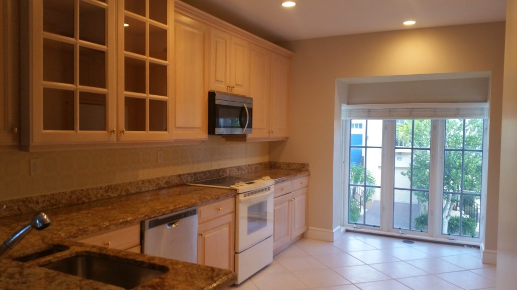
191 Cape Pointe Circle is a single family home located in the Ridge area of the Bluffs development in Jupiter, Florida. This 3 bedrooms, 2 bathroom, 2 car garage home is priced to sell. The home needs some updating, but has the potential to be a beauty. This one story home has an open floor plan with vaulted ceilings and a loft, bonus area. Close to the beach, shops and restaurants. The bluffs has a community swimming pool, tennis and basketball court and the low HOA fees include cable and front lawn service. Up to two pets are permitted by the association.
What are the effects of sea level rise on Palm Beach County Real Estate?
A few months ago I wrote this post on the effects of sea level rise on waterfront property and I also wrote this post on the effects of king tides.
Well, along the way, as is usually the case for me, I got the answer to one question which led me to the next one. In this case I noted a difference between the actual high tide level and the predicted high tide level for a “king tide” on that day at the Lake Worth Pier. I found the answer to it and posted in in this blog. In doing so THIS TERRIFIC PAPER on the projected sea rise level was sent to me. Prepare to be shocked!!!
“In the short term, sea level rise is projected to be 6 to 10 inches by 2030 and 14 to 26 inches by 2060 (above the 1992 mean sea level). In the long term, sea level rise is projected to be 31 to 61 inches by 2100. For critical infrastructure projects with design lives in excess of 50 years, use of the upper curve is recommended with planning values of 34 inches in 2060 and 81 inches in 2100. The National Aeronautics and Space Administration Jet Propulsion Laboratory (2015) has reported the average global sea level has risen almost 3 inches between 1992 and 2015 based on satellite measurements. Sea level rise in South Florida has been of similar magnitude over the same period (NOAA, 2015) but is anticipated to outpace the global average due to ongoing variations in the Florida Currents and Gulf Stream.”
At the Lake Worth Pier the MHW is given as 2.88′ and the elevation of the reference disk at this location is 2.51′ by the 1988 NAVD datum. Thus, and I checked this with NOAA, the MHW calculates to be: 2.88′-2.51′ = 0.37ft above NAVD88 datum or zero level. The projection is for the Mean Sea Level (MSL) to be SOMEPLACE between 14″ and 26″ higher than this by 2060. So, by 2060 the Mean Sea Level is projected to be as high as 2.54′ by the NAVD 88 datum. Looking at my flood Elevation Certificate (EC) I note that my FF EL = 7.5′ (NAVD 88). And we are seeing higher “King Tides” which are routinely ABOUT 1′ higher than the mean high higher water however lately they have been nearly 2′ higher because of CLICK HERE!
Bottom line here is that by 2060 the normal high tide could be as bad as the worse than normal king tides we have been experiencing as of late (fall of 2019) with water levels as high as 2.5′ by the NAVD 88 datum as the new “normal” tide.
473 Juno Dunes Way, Juno Beach
Across from Pelican Lake, Juno Beach and the Atlantic Ocean, 473 Juno Dunes Way is a delightful 3 story townhouse that is an approved short sale and is ready for a little TLC. The unit was built in 2003, with CBS construction and hurricane impact windows. The townhouse has a one car garage and one bedroom and full bathroom on the ground floor. The second floor has a living/dining area and eat in kitchen and half bath. The third floor has a spacious master suite with walk in closets, tray ceiling and master bathroom with shower and tub. The unit is light and bright and has a central vacuum system throughout. Juno Dunes is an enclave of townhouses with a low HOA and a community swimming pool. One pet under 50 lbs is allowed at the discretion of the HOA and 1 lease a year is permitted.
Canals that are not in an HOA in Pirates Cove
Today we are going to look at those waterfront houses in behind Waterway Cafe in what is called Pirate’s Cove.
Pirate’s Cove has waterfront homes on streets such as East and West Teach, Avery & Canal roads. This is unincorporated Palm Beach County but has a Palm Beach Gardens mailing address.

Canals shown on the Plat are for the benefit of all lot owners for all lawful recreational purposes. This is decent verbiage BUT I remember that a few years ago someone had anchored a boat in the lake. Not sure if that was a homeowner who could probably make a case for the right to do this.
VERY interesting that the waterfront lots on Canal Rd are NOT shown on this Plat which may be why some, but not all of them, have carved land out of their uplands and over flowed it for a dock but they do not appear to have a right to come and go over the canal as they are not a lot owner in the subdivision. But the Florida Board of Trustees Land Document System web site shows the State as the owner of the lands below the water in these canals EXCEPT the one that goes along the Waterway Cafe lot. Thus, the public has the right to say moor a boat in that lake and the uplands abutters, including those on Canal Rd, have the right to wharf out to the navigable water to a distance of 1/4 of the canal width. And this accounts for why Waterway Cafe does not have boats ties up along the canal that abuts them.
Why are the South Florida King Tides HIGHER than what NOAA predicted?
OK, so I’m not sure how many people will read this post but about a month ago I did a blog posting on the Effects of the King Tides on Palm Beach Real Estate. When I wrote this post I could see that the actual recorded water level at high tides at the Lake Worth Pier was over one foot HIGHER than what NOAA predicted. WHY? This is one of the main tide gauges used by NOAA to record tide data. Other tide data in the area at places like the the PGA Bridge or even the Port of Palm Beach is based upon the Lake Worth Pier data with a numerical modifier applied. How could they be off by over a full foot?
I just found the answer in THIS ARTICLE which quotes a Brian McNoldy, senior research associate at the University of Miami’s Rosenstiel School of Marine and Atmospheric Research, who notes that: “NOAA’s forecasts on king tides rarely line up with the actual measured high tides. The most recent king tide came in 16 inches higher than NOAA predicted it would. The reasons are a combination of warmer waters at this time of the year, however the The last two king tides also coincided with tropical systems that, although far away from Florida’s coast, played a role in the height of the tides. Hurricane Lorenzo, which became a powerful Category 5 storm thousands of miles away, was roaring through the ocean at the start of the month. For the recent king tide, Subtropical Storm Melissa stomped around New England.”
Even more fascinating as noted in this article is that water has “backed up” in the Gulf of Mexico.
Palm Beach County Schools Choice Program 2019
Palm Beach County parents, mark your calendars, on November 4th, the Choice Program Application Window opens. If you would like your child apply to a choice program at any Palm Beach County School, you will need to apply through the Palm Beach County School District website. If you are wondering how important is your school district, click on the highlighted link. Also, to get more information on the some of the schools in northern Palm Beach County and their programs depending on where you live click on the following link: Northern Palm Beach School District Homes For Sale.
Deadlines to Apply are as follows: December 13, 2019*
-Bak Middle School of the Arts (all programs)
-The Conservatory School @ North Palm Beach (Music-Band & Music-Orchestral Strings for grades 6-8)
-Boynton Beach Community High School (Dance, Digital Media, Music-Band, Music-Keyboard/Piano, Music-Vocal, Theatre, and Visual Arts)
-A.W. Dreyfoos Jr. School of the Arts (all programs)
-West Boca Raton Community High School (Performing Arts)
January 24, 2020*. Application deadline for all Choice programs other than the Arts programs listed above.
- « Previous Page
- 1
- …
- 99
- 100
- 101
- 102
- 103
- …
- 181
- Next Page »


