As storms aproach us everyone reads my post on how to compare storm surge to the elevation of a house. After the storm we can can compare the measured data to what was predeicted.
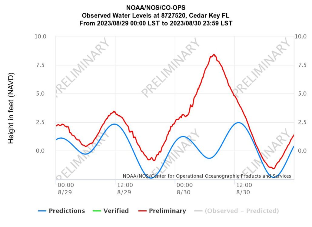
Now, the Cedar Key tide station had pre storm ‘normal’ tides running about 1′ above what was predicted, both high and low tide. Idalia happened to produce the max storm surge right around the ordinary low tide for the area. We had the best case scenario happen. The max storm surge hit at low tide. Storm surge is, by definition, the water ABOVE what would have otherwise been, had there not been a storm. BUT NOAA used the Mean High High Water level when issuing predictions and reports. For Cedar Key, the MHHW at the sensor is +1.54′ NVAD 88. Looking at the graph from the tide station we can see that the actual measured water level maxed out at ABOUT +8.5′ NAVD. Thus, the measured water level at Cedar Key at this tide station was ABOUT 8.5′. The measured surge was 8.5′-1.54′ = ~ 7′. If your first floor around this tide station was lower than +8.5′ then you were wet. And this does not account for locally higher water or wave action. Now Cedar Key is a long way from where the Idalia made landfall but it’s the closest tide station on the right hand side of the storm. The max height of the storm surge even there may not have been at this location. I suspect that when FEMA issues the storm report it will be higher.