I showed the property located at 4312 Blowing Point in the Antigua subdivision in Abacoa recently. This is a more or less typical 3 story townhouse in the community with 3 beds, 3 full baths and one half bath. So this unit has a bedroom and a full bath on the ground floor, a half bath on the second floor with the kitchen, laundry in a closet, living room and a small balcony off of same. Then on the third floor is another balcony off the master, the master and bedroom. This is the model with a loft or sitting area at the top of the stairs and two bedrooms up but one is smaller. Nice unit but not as many builder upgrades as 4316 Blowing Point but it does have tile on the second floor which some people may favor over the wood floors.
4316 Blowing Point Jupiter FL in Antigua Abacoa
I showed the property located at 4316 Blowing Point in the Antigua subdivision in Abacoa recently. This is a more or less typical 3 story townhouse in the community with 3 beds, 3 full baths and one half bath. So this unit has a bedroom and a full bath on the ground floor, a half bath on the second floor with the kitchen, laundry in a closet, living room and a small balcony off of same. Then on the third floor is another balcony off the master, the mast and bedroom. This is the model with a landing at the top of the stairs and two larger bedrooms up. Nice unit with granite counters, wood floors, central vacuum, an intercom, new stainless steel appliances including washer and dryer and custom closets!
2018 Jonathans Landing Equity Memberships
THE FOLLOWING IS AN OLD POST. THIS IS THE LINK TO THE JONATHANS LANDING PAGE WHICH HAS THE CURRENT MEMBERHIP FEES ON IT.
Hot off the presses, here are the new 2018 Membership Opportunities for Jonathans Landing in Jupiter FL
2018 Jonathans Landing Dues and Fees Schedule
Palm Beach County – NGVD 1929 converted to NAVD 1988
With all the talk about Flood Insurance I decided to re-visit this old blog post.
I have an old survey of my property and it shows the finished floor (F.F. EL) of my house as say 8.1′ but this is based upon the NGVD 1929. How do I convert that to the NAVD 1988 which the new flood maps use?
Why would I need this? I like to know the answer to a question before I ask it. If my Lender or Insurer tells me I need an elevation certificate or I think I want one then I want to know if I should: A) fight them to apply the correct logic and classify the building and not my land, or 2) Have an elevation certificate done and ask my insurer to apply the post firm rates because I have enough of an elevation difference between the BFE and my finished floor to really get the rates down IF they insist on incorrectly classifying my building. In order to make this decision I want to know the 1988 FF EL before I push one way or the other. Also, it can be helpful to dtermine if a forcast storm surge will affect my property.
The Flood Insurance Rate Maps (FIRM) Maps were developed based upon the National Geodetic Vertical Datum of 1929 or NGVD 29. However there is a more current version of this which is the North American Vertical Datum of 1988 (NAVD 88) and the new (as of October 2017) flood zone maps use this new datum. The datum is defined as:
Datum: A reference surface used to ensure that all elevation records are properly related. The National Flood Insurance Program previously used the National Geodetic Vertical Datum (NGVD) of 1929, but all recent FIRMs have used the North American Vertical Datum (NAVD) of 1988. Both datum planes express elevations in relation to sea level.
So, when we see on the new flood zone maps ZONE AE (EL 6) this means that the Base Flood Elevation (BFE) has been determines and it is 6′ above the NAVD 1988.
To Convert these elevations to the NAVD 88 Datum we use this page…
https://www.ngs.noaa.gov/cgi-bin/VERTCON/vert_con.prl
So, let’s look at 300 Xanadu Place. Looking this up on the County GIS site or where ever we get the Lat/Lon: 26.9247024, 080.0694433 and we see the difference is -1.59′. (Note that I recently looked at a property on the St Lucie River in Palm City and the conversion there was -1.45′) These adjustments vary by location but this is very close to the published Palm Beach County wide ‘ball park’ number of -1.56′. So in this example location if say the elevation shown on an old survey was 8.1 according to the 1929 datum then the 1988 datum elevation is 8.1′-1.59′ = 6.51′.
And, the flood zones are defined as:
Special Flood Hazard Area (SFHA). An area having special flood, mudflow or flood-related erosion hazards and shown on a Flood Hazard Boundary Map (FHBM) or a Flood Insurance Rate Map (FIRM) Zone A, AO, A1-A30, AE, A99, AH, AR, AR/A, AR/AE, AR/AH, AR/AO, AR/A1-A30, V1-V30, VE or V. For the purpose of determining Community Rating System (CRS) premium discounts, all AR and A99 zones are treated as non-SFHAs.Shaded Zone X is a moderate risk areas within the 0.2-percent-annual-chance floodplain, areas of 1-percent-annual-chance flooding where average depths are less than 1 foot, areas of 1-percent-annual-chance flooding where the contributing drainage area is less than 1 square mile, and areas protected from the 1-percent-annual-chance flood by a levee. No BFEs or base flood depths are shown within these zones. (Zone X (shaded) is used on new and revised maps in place of what was Zone B.)
Palm Beach County Flood Insurance for Real Estate – 2018
OK, the new Flood Maps are out and effective and I had the ‘opportunity’ recently to learn much more than I ever thought I would want to about flood insurance. First, for those of us in Palm Beach County, start here (https://maps.co.palm-beach.fl.us/cwgis/?app=floodzones) to determine what flood zone you MIGHT be in. Flood insurance is based on your building, specifically the lowest floor elevation of the living space, NOT your land. The problem is that most computer programs, like the one used by the County, can only ‘see’ where a flood zone contour crosses your property line. If the building is within the aqua colored dotted area or the aqua colored line around this area crosses through your building then at first look your ARE in the Special Flood Hazard Areas (SFHAs) – Zones: A, AE, AH, AO.
If the contour passes close to your building or you think the map is wrong or your lender/insurer refuses to apply the logic outlined in the FEMA Flood Insurance Manual (FIM) on classifying the building (NOT THE LAND) you can apply to FEMA for a Letter of Map Change and ask for a Letter of Map Amendment. FEMA will tell you what the official determination is. The process is easy and it’s free if your house was built pre FIRM.
CLICK HERE for my post on how to determine if your house is pre or post FIRM
IF you are in a SFHA, or the line goes through your building or touches it or basically IF YOU ARE GETTING ANYTHING OTHER THAN A ‘PREFERRED RATE’ FLOOD POLICY then you should hire a Land Surveyor to prepare an Elevation Certificate and it all has to do with something called Freeboard. Freeboard is the distance between the Base Flood Elevation and your finished floor elevation. In pre FIRM construction all that matters to get the best rates is for the Lowest Adjacent Grade to the building to be higher than the Base Flood Elevation or BFE. In my area the BFE is shown on the maps as say ‘BFE 6′, which is to say that the Base Flood Elevation has been determined to be 6’ above the 1988 datum or baseline. I am in Zone X but the zone AE (BFE 6) goes in front of my house. Let’s look at this and the difference in insurance costs for a Zone X and a Zone AE. Remember Zone AE is in the SFHA.
FOR POST-FIRM CONSTRUCTION
If you have an elevation certificate (weather your house was pre or post FIRM construction) then you should be able to use the ‘Post FIRM’ Zone AE insurance rates found in the FIM which account for freeboard and are significantly lower. For comparison. A pre FIRM (pre 1974) building in Zone B,C,X,AR and A99 pays $344 for a preferred risk policy as a flat rate for 250k of building coverage. A pre FIRM building in Zone AE, where the AE zone contour goes through your house, is $2,304. BUT, if you have an elevation certificate and the finished floor inside your house is just 1′ above the 6′ elevation (BFE) then you pay $769 for 250k of coverage. If your interior floor is 2′ above the 6′ Base Flood Elevation defining this AE Zone then you pay $453 for 250k of building coverage. I paid $250 for an elevation certificate from Legacy Surveying (Office@LegacyPSM.com) in Tequesta.
NOTE FOR PRE-FIRM CONSTRUCTIONhttps://MAIL TO: office@legacypsm.com
If you in a pre firm constructed house then you may use the method outlined above OR you may apply for a Letter of Map Amendment with FEMA. You will need an Elevation Certificate F-053_EC_May2017_RE_rev an Elevation Form MT-1 Form 2 – Elevation Information Form to do this. If you are in a pre FIRM constructed house then basically you don’t need much freeboard to get the preferred risk policy rates. All that is required is that the Lowest Adjacent Grade to your structure be higher than the Base Flood Elevation. So in my neighborhood most houses are pre FIRM and the Base Flood Elevation is 6′ measured from the 1988 datum and all the houses are the standard slab on grade. So if the Lowest Adjacent Grade to the house is greater than 6′ then you should apply for a Letter of Map Amendment from FEMA. This sounds like a big deal but really it’s not. Here’s a little trick I found. In my rush for fame and glory I applied through the on line system at the FEMA web site. They came back and said I needed an Elevation Certificate. NO reasoning with the bureaucrats on this so I got one. BUT IF I HAD USED THERE PAPER FORM THERE IS PLACE ON IT WHERE A SURVEYOR CAN CERTIFY THE LOWEST ADJACENT GRADE IS ABOVE THE BASE FLOOD ELEVATION. That’s it. No more documentation should be required.
I APPLIED FOR A LETTER OF MAP REVISION AND I GOT ONE. CLICK HERE TO READ ALL ABOUT IT.
An Elevation Certificate is well worth it.
Special Flood Hazard Area (SFHA). An area having special flood, mudflow or flood-related erosion hazards and shown on a Flood Hazard Boundary Map (FHBM) or a Flood Insurance Rate Map (FIRM) Zone A, AO, A1-A30, AE, A99, AH, AR, AR/A, AR/AE, AR/AH, AR/AO, AR/A1-A30, V1-V30, VE or V. For the purpose of determining Community Rating System (CRS) premium discounts, all AR and A99 zones are treated as non-SFHAs.
Shaded Zone X is a moderate risk areas within the 0.2-percent-annual-chance floodplain, areas of 1-percent-annual-chance flooding where average depths are less than 1 foot, areas of 1-percent-annual-chance flooding where the contributing drainage area is less than 1 square mile, and areas protected from the 1-percent-annual-chance flood by a levee. No BFEs or base flood depths are shown within these zones. (Zone X (shaded) is used on new and revised maps in place of Zone B.)
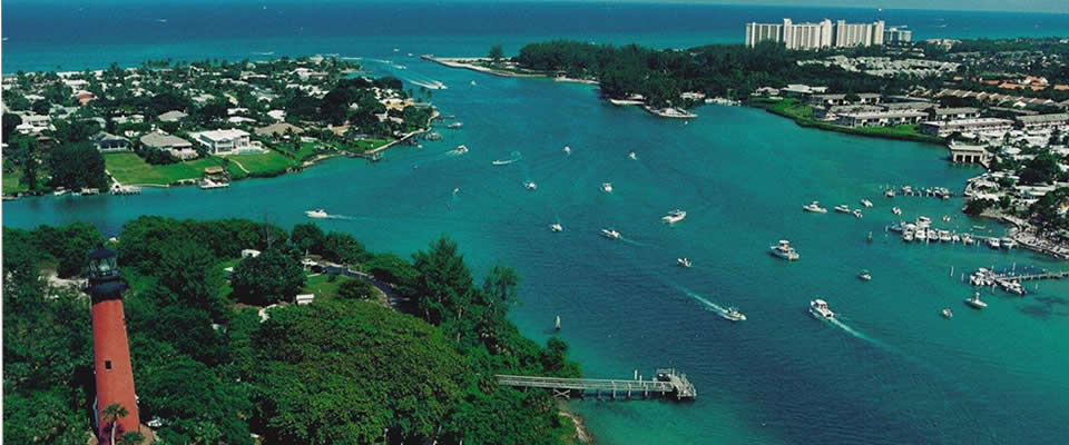
Why we live near the water…
How to check my flood zone in Palm Beach County Florida
So Chris, How do I find out what my flood zone my house is in, if it is?
In Palm Beach county this is now very easy thanks to the folks in the GIS department at the county. Go to this web site…
Just enter your property address and presto. This tool reports the flood zone designation OF THE ZONE THAT TOUCHES YOUR PROPERTY AND THE “PENDING fLOOD ZONE”.
The Pending flood zone is based upon the maps proposed in Dec 2019. The adoption of those was put off due to COVID and (thanks in no small aprt to myself) the country contested the accuaracy of tose maps. And now in 2023 they are appealing the FEMA denial of the contention to basically a committee of scientists. ANYWAY with risk rating 2.0 the FIRM maps are NO LONGER used to price your flood insurance BUT they are still used by the banks to determine if they will require you to carry flood insurance. And they are used by the building department to determine how the proeprty can be built upon and/or rebuilt after a flood.
Be aware, just because a flood zone or a Special Flood Hazard Area touches your property, that does not necessarily mean your building is located within the flood zone. The link above STATES the flood zone of the lot is say an AE if the contour goes through the lot, but it MUST touch the structure. Please carefully note the structure’s location in relation to the SFHA boundaries shown in the viewer to determine whether or not your structure is located within a SFHA. If it’s in question then the building department will requir and elevation certificate from a surveyor.
If you reside in the unincorporated area and are uncertain please call the Palm Beach County Flood Information Hotline at 561-233-5374. If you reside in a municipality you should contact your local floodplain administrator.
Or, you can also use the FEMA Map Page.
- « Previous Page
- 1
- …
- 109
- 110
- 111
- 112
- 113
- …
- 159
- Next Page »